
Trace a Poughkeepsie Street by Address
The most useful Poughkeepsie street directory trail is a controlled sequence. The address first identifies a place. The municipality then identifies the right local record path. ParcelAccess can connect that place with a parcel number and owner of record, and the Dutchess County Clerk can connect the parcel’s deed reference with an ownership instrument. A voter tool has a narrower role: it is a registered voter’s confirmation service, not a broad street list. Older directory volumes then add a dated street-based clue. None of those records alone proves that an owner, mailing addressee, or historic listing occupies the address now.
- Enter the full address in Dutchess ParcelAccess, retaining the number and street spelling used in the result.
- Confirm the municipality shown on the parcel. City of Poughkeepsie and Town of Poughkeepsie records are separate, even when a mailing line says Poughkeepsie.
- Record the parcel number, parcel location, owner name, primary owner mailing address, and deed book or page fields. Those are parcel and ownership signals, not occupancy findings.
- Use the deed reference or party name in the Dutchess County Clerk Document Search to examine the instrument chain.
- Use New York’s voter lookup only for its controlled registration-confirmation route. It requires county, name, date of birth, and ZIP, and is not a by-address directory.
- For a dated household or business clue, consult a historical criss-cross or city directory after preserving the street spelling and year.
Keep a short note beside each result: source, record year, municipality, and role. That habit prevents a current parcel card from being confused with an older resident listing.
Set Poughkeepsie Street Municipality First
Poughkeepsie is not one record jurisdiction. The incorporated City and the surrounding Town have distinct assessors and municipal files, while Dutchess County supplies the shared land-record, tax, election, and parcel infrastructure. The Eighth Ward was annexed from the Town in 1929, which makes the record year important when an address crosses the City and Town history. A City record can be the wrong starting point for a Town parcel, and the reverse is also true.
Postal information should not settle that question. USPS can return a Poughkeepsie city line for an address outside the City, and 12603 reaches Arlington and Town delivery territory as well as City-linked areas. Use the USPS ZIP Lookup to standardize a delivery address, then use ParcelAccess to confirm the parcel municipality. This is the geography check behind a reliable street directory search.
Note: A ZIP and a mailing city help route mail, but neither one establishes the municipality that holds an address record.
Read Poughkeepsie Street ParcelAccess Fields
ParcelAccess is Dutchess County’s street-to-parcel crosswalk. Its Parcels area offers Parcel Lot, Owner Name, and Address modes, with Sales, Assessments, and Filed Maps available as separate tabs. The map can be searched by address or parcel, clicked, measured, filtered by layers, and printed. A nearby-parcel tool works from drawn map geometry, so it is useful for parcel context rather than a list of private households.
| ParcelAccess mode | Fields observed | Street-directory use |
|---|---|---|
| Parcel Lot | Lot number; municipality | Find a known parcel within the correct local jurisdiction. |
| Owner Name | Last name; first name; municipality | Check an owner-of-record clue without treating it as residence evidence. |
| Address | Number; Predir; Street; Postdir; Suffix; municipality; partial street accepted | Translate a street address into a parcel identity and parcel location. |
Results can include parcel number, associated grid numbers, parcel location, municipality, owner name, primary owner mailing address, lot size, land use, assessment, market value, school district, agricultural district, roll section, tax code, and deed information book or page. An assessment update is tied to the county’s cycle and ownership is stated as of March 1, so later changes call for the newest roll, local assessor, or Clerk instrument.
The ParcelAccess search interface shows the address and parcel modes used for a Poughkeepsie street search.
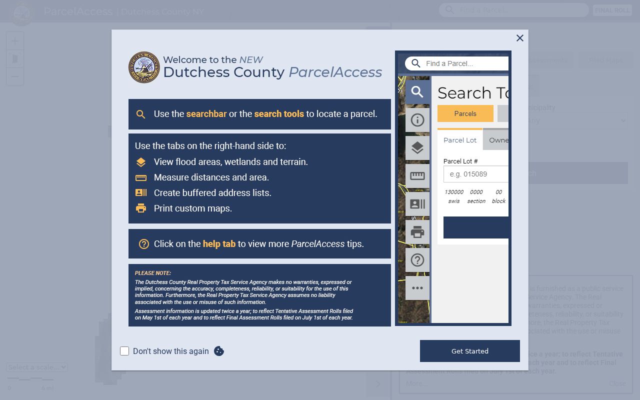
Use its municipality and parcel-location fields before following an owner or mailing-address field into another record series.
Compare Poughkeepsie Street Records
Address-keyed sources answer different questions. The current roll is a dated assessment snapshot. ParcelAccess supplies the crosswalk and deed reference. County Clerk documents record transactions and named roles. Historical tax rolls preserve annual owner and assessment snapshots. Building records have no documented searchable public index, so the Building Department counter or a focused City FOIL request is the fallback for a defined record.
| Address-keyed source | Custodian | Coverage or fields | Access route |
|---|---|---|---|
| ParcelAccess | Dutchess Real Property Tax Service Agency | Parcel location, municipality, owner, mailing address, assessment, deed book/page | Online map and parcel viewer |
| Current assessment rolls | County host and local assessors | Parcel, location/class, owner, mailing address, values, exemptions, school district | Annual municipal PDFs and local assessor |
| Historical tax rolls | Dutchess Real Property Tax | 1952-2019 owner, property location, assessment, exemption, roll year, municipality | Online TaxRolls viewer |
| Deeds, mortgages, liens | Dutchess County Clerk | Party, type, instrument date, liber/page or document number, municipality, image | Online index, Record Room, mail-copy and certified-copy routes |
| Permit or property-maintenance record | City Building Department | Defined permit, certificate, inspection, or related municipal file | Counter or targeted FOIL route when no public index exists |
The parcel number links the roll and map to a deed trail more reliably than a street name alone. A street name remains useful for locating a historic directory or map, but old and modern labels should be matched by date.
Dutchess County’s current assessment-roll page provides the municipal roll route for a current Poughkeepsie address.
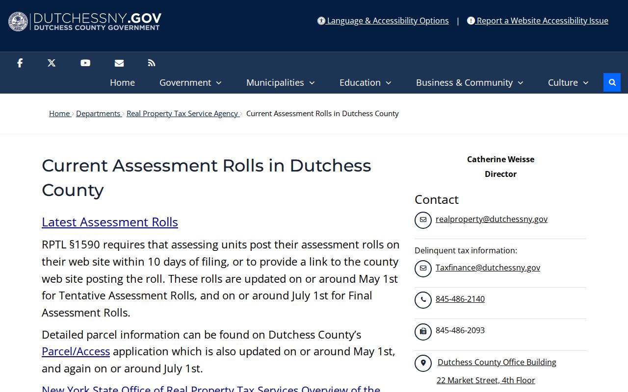
The current rolls show why a parcel location and an owner mailing address need to be read as separate fields.
Follow Poughkeepsie Street Deed References
The County Clerk’s document search is the next stop after a parcel identifies a deed book or page. Its visible routes include Search, Historical Search, Request Mail Copies, View Cart, and Help. The name form accepts a last-first format with a modifier and as many as three name criteria. Recorded-date ranges, document year and number, liber and page, document type, and LP controls provide other ways to narrow a search. LP means lis pendens, a notice of lawsuit.
The observed result schema includes Party Name, Type, Year, Document Number, Liber, Page, Municipality, Party Type, Date Recorded, Comment, and Complement Name. That is a record of an instrument and party role, not a direct statement of who lived at the property. Deed images are generally online from 1907 with current material, while the stated mortgage-image coverage begins in 1981 or 1989 depending on the period. Older or missing images may require the Record Room, a mail-copy request, or help from the County Clerk.
The County Clerk Document Search form displays the name, date, document-number, and liber-page paths into the land-record index.
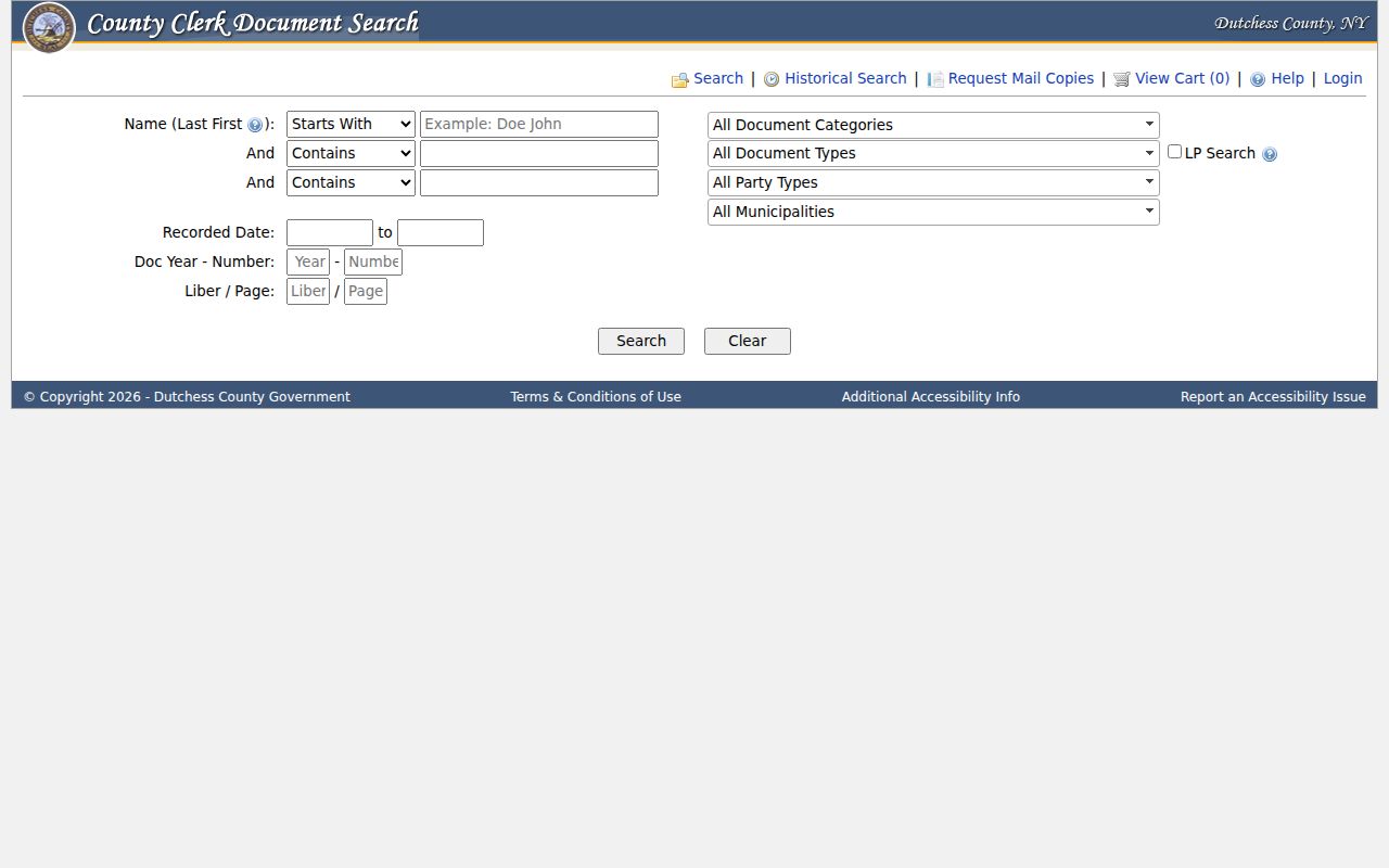
Preserve the municipality and party type with each hit so an ownership transfer is not mistaken for a current street listing.
Note: The County Clerk reported a temporary Record Room relocation beginning January 15, 2026, so verify counter instructions before an in-person visit.
Check Poughkeepsie Street Tax Roll Years
Dutchess Historical Tax Rolls supplies a year-by-year back-search from 1952 through 2019. The viewer uses Tax Roll Year and Municipality selectors followed by Search. Select City of Poughkeepsie when the parcel belongs to the City; the Town is a separate choice. Large rolls can run to hundreds or thousands of pages and exceed 100 MB, so downloads may take time and text search quality can vary.
Extract only the fields needed to connect the address across time: the owner, parcel or property location, assessment, exemptions, roll year, and municipality. Compare a year’s parcel description with the next and then test an ownership change in the deed index. The county hosts the historical system and tax maps, while local assessors maintain assessment, exemption, special-district, and mailing-address information.
The Dutchess Historical Tax Rolls viewer exposes the year and municipality selectors for the Poughkeepsie street record trail.
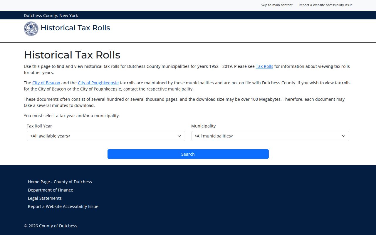
The separate municipality selector is essential when following a Poughkeepsie address through the historical rolls.
Date Poughkeepsie Street Numbers
Poughkeepsie’s numbering code traces to a March 4, 1929 ordinance. It requires buildings to display the number assigned by Dutchess County Emergency Response, with unit identifiers possible under one assigned street number. That rule is a useful date marker, not a universal conversion key. A number found in a 1929 source should be tested against the directory, tax roll, deed, or map from its own period before being equated with a modern address.
Street labels also change. The City adopted street-naming criteria in 1983 for new thoroughfares, allowing names tied to local people, landmarks, topography, or veterans and distinguishing road, avenue, street, boulevard, highway, drive, lane, place, and court. DCHS identifies Young Street as named in 1924 for Pvt. John M. Young. A specialized genealogy list offers possible changes such as Cataract Place to Mt. Carmel Place and Mansion East to Pershing Avenue, but those are leads to verify with ordinances, directories, Sanborn sheets, and DCHS maps.
The 1955 official map and the 1929 numbering ordinance provide two checkpoints. A directory’s period spelling should stay in your notes even after a modern GIS search returns another label.
Map Poughkeepsie Street Continuity
The City’s Historic Resource Inventory adds a by-street continuity layer with street, number, 1977 or 2019 photo and status, ward, and color or status fields. It is useful for checking whether a historic address belongs to a documented place, especially in the official historic districts. It does not identify a current resident. The official historic-district overview names Balding Avenue, Mill Street and North Clover, Upper Mill Street, Union Street, Academy Street, Garfield Place, and Dwight Hooker areas.
Use the map sequence as an address test: compare the directory’s year and wording with a DCHS map or Sanborn sheet, retain the old street label, and then verify the modern parcel municipality. The 1929 annexation is another reason to date every result before selecting a City or Town custodian.
Use Poughkeepsie Street Criss-Cross Clues
A criss-cross directory reverses the usual name-to-address arrangement by organizing entries around a street. It is useful after the parcel and municipality are known because it can place a name or business at an address in a specific publication year. Poughkeepsie’s historical directory collections include names, streets, and occupations, but a business listing is not automatically a residence finding. The fuller historical shelf, including PPLD’s digitized material and its access limits, is detailed in the Poughkeepsie Directory Book.
- Parcel
- A defined unit of land used by the assessment and GIS systems, usually connected to a parcel number or grid identifier.
- Situs address
- The physical parcel location. It can differ from the primary owner mailing address shown in a roll or parcel result.
- Plat
- A mapped subdivision or land plan used to show lots, boundaries, and related parcel geography.
- Criss-cross directory
- A directory arranged by street or address, allowing a dated address to be checked against entries in that volume.
Maps add the physical context. DCHS lists Poughkeepsie maps from 1780 through 1929, while the Library of Congress has 1913 material republished in 1950. Sanborn sheets can show building footprints, uses, materials, heights, street and block numbers, and boundaries. They establish dated block context, not present-day occupancy.
Keep Poughkeepsie Street Research Lawful
A Poughkeepsie street directory cannot provide a complete list of people at an address. Parcel and roll results may identify an owner and a mailing address. A deed establishes a transaction. A historical directory records a year-specific listing. Voter lookup is controlled, confidential voter records are segregated, and Address Confidentiality Program participants use protected substitute-address procedures. A blank or limited result can reflect a real access boundary rather than a failed search.
Lawful personal research. Use address records for legitimate personal, family-history, property, or civic questions. Do not use public information to stalk, harass, intimidate, or expose a protected person.
For material that is not indexed, name the exact record, property, date range, and custodian in a request. The City Chamberlain’s FOIL process, the Building Department counter, the County Clerk, the County Historian, and the library are separate routes with different holdings. Keep sensitive identifiers and protected locations out of research notes.